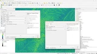
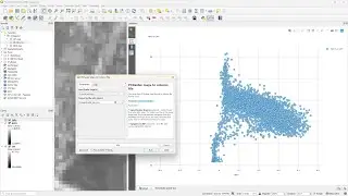
Interpolating Point Clouds to Raster with IDW and TIN in QGIS
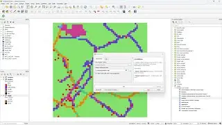
Since QGIS 3.32 Lima, native processing tools are available in QGIS to interpolate point clouds to rasters. First we'll use the Inverse Distance Weighting (IDW) method to create rasters of different spatial resolutions. Next, we'll use the triangulation (TIN) method and compare the results. For comparison, we'll use 2 linked 2D views and elevation profiles.
QGIS version: 3.32 Lima
Open Data: AHN4 from https://geotiles.nl/
Blog on native point cloud processing in QGIS by @LutraConsulting: https://www.lutraconsulting.co.uk/blo...
Do you want to learn more about point cloud processing and 3D visualization in QGIS? Enroll for my course at @udemy : https://www.udemy.com/course/qgis-poi...
0:00 Introduction
1:03 IDW interpolation
3:23 TIN interpolation
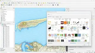
4:39 Create map themes
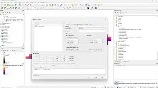
5:10 Create two linked 2D Map Views
5:48 Elevation profiles
#qgis #pointcloud #3d
Watch video Interpolating Point Clouds to Raster with IDW and TIN in QGIS online, duration hours minute second in high quality that is uploaded to the channel Hans van der Kwast 19 July 2023. Share the link to the video on social media so that your subscribers and friends will also watch this video. This video clip has been viewed 4,953 times and liked it 84 visitors.

![[YTP] BrayaB Wyatt ends a RawR with MaM Hardy {WWE}](https://images.reviewsvideo.ru/videos/l60P8SIe5yc)