Calculate Zonal Statistics of Sentinel-2 derived NDVI for parcels in QGIS
This video shows how to download Sentinel-2 bands with the STAC-API Browser plugin. Next, NDVI is calculated with the Raster Calculator. Finally, for all parcels in a polygon layer the zonal statistics of NDVI are calculated (mean, standard deviation, minimum, maximum) and their areas and perimeters are added to the attribute table.
QGIS version: 3.28.3
Plugins: STAC API Browser plugin
Data: PDOK
0:00 Introduction
0:10 Install the STAC API Browser plugin
0:28 Download Sentinel-2 Level 2A images
1:59 Calculate NDVI with the Raster Calculator
2:44 Reproject and clip the NDVI layer
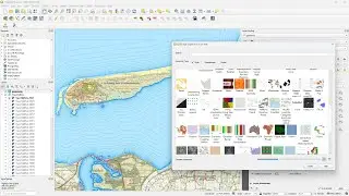
4:20 Style the NDVI layer with a colour ramp
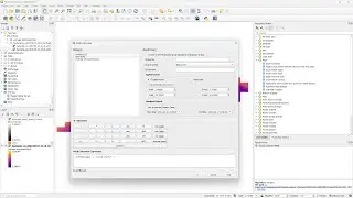
4:47 Calculate Zonal Statistics of NDVI for parcels
7:03 Calculate area and perimeter of parcels
#QGIS
Watch video Calculate Zonal Statistics of Sentinel-2 derived NDVI for parcels in QGIS online, duration hours minute second in high quality that is uploaded to the channel Hans van der Kwast 26 February 2023. Share the link to the video on social media so that your subscribers and friends will also watch this video. This video clip has been viewed 4,284 times and liked it 145 visitors.