Quantity Surveying Software by ESurveying Softech
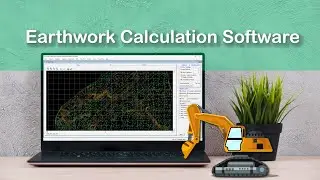
Using ESurvey Earthwork Estimating Software (Quantity Survey Software) you can prepare Quantity Takeoff reports in various earthwork projects. ESurvey Earthwork prepares cut and fill area reports and volume reports by doing calculation using section method, average area method. It can also find the optimal formation level (mass haul) for a given set of data in any earthwork project.
Read More:
https://esurveying.net/earthwork-soft...
Earthwork Calculation Software Introduction (Continued)
Hello everybody, this is 2nd video about “Introduction to Earthwork Module of ESurvey CADD. In the first video, we have seen how to create earthwork calculations using AutoCAD Drawing.
In this video, we will discuss 3 more features of Earthwork Module
a) Find optimum level
b) How to do earthwork calculation depending on the depth of Cutting and height of lift
c) How to Export Grid data into Excel
Find optimum level
In the earthwork module, there is an option, using which we can find optimum formation levels. In this demonstration project, we have base surface values between 17 and 29, if we need to find the formation Level at which cutting and filling will be equal, we can do that by selecting the “Mass Haul Analysis” option from “Earthwork” Menu. The software will compute volumes assuming various formation levels and find the best possible value where cutting volume and filling volume will be almost equal.
Earthwork Depending on the depth of cutting and Height of filling
In some of the earthwork projects payment to contractors will be done depending on the depth of cutting or height of lift. In such cases, volume reports being generated depending on the depth of cut or height of lift. In such cases, we have to select the ‘Advanced’ button and in this window, we can create volume calculation ranges. Say if you want to generate a separate report for earthwork calculation for the top layer between earth up to 1 M depth of cut we have to make those entries in cutting grid. Similarly, we can enter height ranges in the filling tab. After defining all the ranges if we click on the calculate button, then drawings will be generated with respective cross-section lines and related reports can also be generated.
How to Export Grid data into Excel
Once we do earthwork calculation grid values may be required to be exported to excel. Select earthwork - export and select grid elevation tabular format and click on the export button. The software will generate an excel sheet which represents the grid levels.
Thank you for watching this video and if you want more information about ESurvey CADD to visit https://esurveying.net/earthwork-soft...
Watch video Quantity Surveying Software by ESurveying Softech online, duration hours minute second in high quality that is uploaded to the channel ESurveying Softech (India) Pvt. Ltd. 04 September 2015. Share the link to the video on social media so that your subscribers and friends will also watch this video. This video clip has been viewed 7,037 times and liked it 49 visitors.


![Generate Cross Section Drawing in AutoCAD from Excel [Software]](https://images.reviewsvideo.ru/videos/DHNsVKbI4-w)


![Extract Elevations from Google Earth [Easy Way]](https://images.reviewsvideo.ru/videos/Xj86tzCpgbI)