Interpolation of Land Survey data
Read More:https://esurveying.net/interpolation-...
-------Contents of this Video------
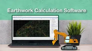
Hello Everybody in this video tutorial interpolation module of ESurvey CADD is explained in brief. Interpolation of Land Surrey Data can be done easily with the Interpolation module of ESurvey CADD. You can do 3 types of Interpolation, i.e., Interpolation using Stright Line Method, Interpolation using Triangulated Irregular Network (TIN) or using Interpolation using 3D Line Method depending on data that you capture during Land Survey.
#interpolation, #landsurvey, #infrastructure, #autocad, #bricscad, #totalstation
-------Related Subjects----------
Interpolation of Land Survey data
Land Survey
Triangulated Irregular Network
Surface
Cross Section
Interpolation methods
Interpolation
Interpolation using TIN
linear interpolation
Data interpolation techniques
3D Line Method
Software
Autocad
Esurvey CADD
BricsCAD
ZWCAD
GSTAR CAD
Infrasturcture Engineering
Cross Section
Longitudinal Section
----Information about channel------
Subscribe to our YouTube Channel: / esurveyingnet
Realated other video links: • Import Survey Data into CAD Package b...
• Video
----Social media----
Follow us on facebook: / esurveying
Read more: https://esurveying.net/railway-box-cu...
Watch video Interpolation of Land Survey data online, duration hours minute second in high quality that is uploaded to the channel ESurveying Softech (India) Pvt. Ltd. 25 August 2015. Share the link to the video on social media so that your subscribers and friends will also watch this video. This video clip has been viewed 6,192 times and liked it 32 visitors.


![Generate Cross Section Drawing in AutoCAD from Excel [Software]](https://images.reviewsvideo.ru/videos/DHNsVKbI4-w)


![Extract Elevations from Google Earth [Easy Way]](https://images.reviewsvideo.ru/videos/Xj86tzCpgbI)