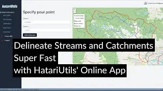
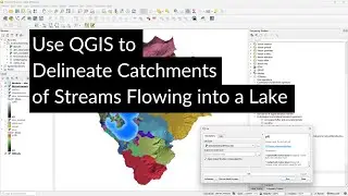
Use QGIS to Delineate Catchments of Streams Flowing into a Lake
In this video, you'll learn how to delineate catchments of streams that drain into a lake. First, we'll download the lake from OpenStreetMap. Next, we'll create a mask polygon that we'll use to mask elevation values in the lake. Finally, we'll use the Pit and Catchment tools of the PCRaster Tools plugin to delineate the catchments.
QGIS version: 3.28
Plugins: QuickOSM, PCRaster Tools
Open Data: SRTM, (c) OpenStreetMap Contributors
Thanks to Melina for discussing this case study with me, which was the inspiration for this video.
0:00 Introduction
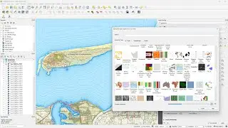
0:39 Download lakes with QuickOSM
2:33 Create a polygon from the DEM extent
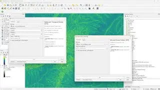
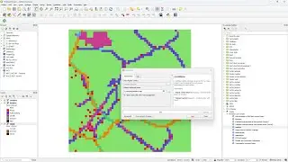
3:06 Use the Difference tool to clip the lake from the extent polygon
3:50 Use the difference layer to mask the lake from the DEM
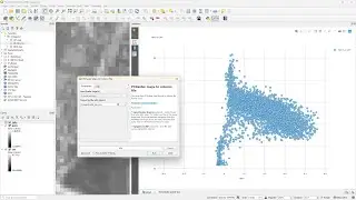
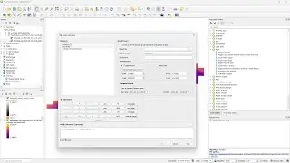
4:39 Convert to PCRaster format and calculate flow direction
5:33 Use the Pit tool to create the layer with outlets
6:05 Use the Catchment tool to delineate the catchments of the outlets
#QGIS #PCRaster #QGISHydro
Смотрите видео Use QGIS to Delineate Catchments of Streams Flowing into a Lake онлайн, длительностью часов минут секунд в хорошем качестве, которое загружено на канал Hans van der Kwast 30 Декабрь 2023. Делитесь ссылкой на видео в социальных сетях, чтобы ваши подписчики и друзья так же посмотрели это видео. Данный видеоклип посмотрели 2,603 раз и оно понравилось 92 посетителям.