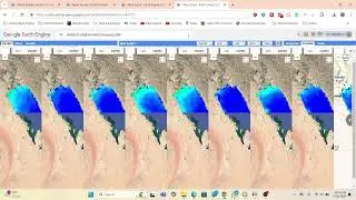
How to Export Waterbodies, Lake, or any shapefile from Google Earth Engine? Export shapefile in GEE
How to Export Easily River, Lake, or any shapefile from Google Earth Engine? Export shapefile in GEE
ENROLL IN THE FULL COURSE TO LEARN ALL ABOUT BASIC SATELLITE REMOTE SENSING AND GIS ANALYSIS USING GOOGLE EARTH ENGINE (GEE), THROUGH ONLINE LIVE CLASS, Contact this email for more information: [email protected]
Course Content:
1) How to use Basic JavaScript Syntax in GEE JavaScript API
Link: • Video ...
2) Beginner's Course on Google earth Engine part:1
Link: • Beginner's Course on Google earth Eng... ...
3) Beginner's Course on GEE; Client Vs Server Object. How You Get The Server to Execute Your Code?
Link: • Video ...
4)How to import Raster and Vector data and display it in GEE JavaScript API?
Link: • Video ...
5) Earth Engine public data catalog. How to Import, Filter, Reduce, Clip and Display data in GEE?
Link: • Video ...
6) Google Earth Engine Beginner's Course Filtering and Displaying Least Cloudy Landsat satellite Images
Link: • Video ...
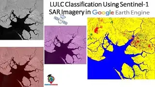
7) Supervised classification in Google Earth Engine || Land Use and Land Cover Classification.
Link: • Supervised classification in Google E... ...
8) How to Make a Chart in Google Earth Engine JavaScript API || Analysis of the GPM 3hr dataset using GEE
Link: • Video ...
9) How to calculated NDWI and NDVI using Modis and Landsat satellite images in Google Earth Engine API
Link: • Video ...
10) Google Earth Engine Beginner's Course Filtering and Displaying Least Cloudy sentinel-2 Images
Link: • Video ...
11) Spectral indices and develop the skills for calculating any index (NDVI, NDWI, NDSI, MNDWI, MSAVI)
Link: • Video
12) Visualization of GPM and observations at three-hour intervals data using Google Earth Engine
Link: • Video
13) Visualization (DEM) of Hillshade and Slope Map in GEE using NASA SRTM Digital Elevation 30m dataset
Link: • Video
14) Google Earth Engine: How to make an NDVI chart over a period of time
Link: • Video
15) Air Quality Monitoring: Nitrogen Dioxide (mol/m^2) density using Google Earth Engine JavaScript API
Link: • Air Quality Monitoring: Nitrogen Diox...
15) Monitoring vegetation condition in Google Earth Engine Part: 1 || Enhanced Vegetation Index || EVI
Link: • Monitoring vegetation condition in Go...
16) Air Quality Monitoring: Sulphur Dioxide (mol/m^2) density using Google Earth Engine JavaScript API
Link: • Video
17) Land Surface temperature in GEE || Observe temporal patterns in LST using time series Chart in GEE
Link: • Video
18) Calculating Area in Google Earth Engine; Part 1
Link: • Video
19) Elevation Profile using the Google Earth Engine, Part: 1
Link: • How to Create elevation profile usin...
20) How to monitor Drought using the indices VCI, TCI, and VHI; in Google Earth Engine, Part: 1
Link: • Video
21) How to Calculate Average, Maximum & Minimum NDVI in Google Earth Engine || Beginner's Course on GEE
Link: • Video
22) Google Earth Engine: How to ADD A LEGEND TO TO YOUR LULC Map using GEE, Part:1
Link: • Video
23) Google Earth Engine Training For Earth Observation Applications || Beginners to Advanced Level, p:1
Link: • Video
24) Google Earth Engine Beginner's Course using the python earth engine API in COLAB, Part:1
Link: • Google Earth Engine Beginner's Course...
25) How to Download Air Quality parameters Timeseries data in CSV format using Google Earth Engine
Link: • Video
26) Monitoring Land Surface Temperature using Google Earth ENGINE | LST Time Series Analysis in Celsius
Link: • Video
27) How to make Landcover Classifications Charts in Google Earth Engine | LULC Map Chart | GEE LULC
Link: • Video
Subscribe and Keep in touch with this YouTube channel for more training season.#Google_Earth_Engine #Google #Earth_Engine
If you need this other advanced tutorial, tell me in the comment section.
If you want to learn the Google Earth Engine course, Please Contact this Email: [email protected]
Join Telegram group: https://t.me/gisandremotesenginglearn...
Join What's App Group: https://chat.whatsapp.com/DJyR6BjhnBa...
Join Skype Group: https://join.skype.com/ym0c1b7bjxHH
Watch video How to Export Waterbodies, Lake, or any shapefile from Google Earth Engine? Export shapefile in GEE online, duration hours minute second in high quality that is uploaded to the channel Study Hacks-Institute of GIS & Remote Sensing 01 June 2021. Share the link to the video on social media so that your subscribers and friends will also watch this video. This video clip has been viewed 14,255 times and liked it 222 visitors.