Import Latitude & Longitude Coordinates to Google Earth Engine from CSV Excel file || Earth Engine
Import Latitude & Longitude Coordinates to Google Earth Engine from CSV Excel file || Earth Engine
#registrationopen for new batch || 1st 5 registered people get 50% discount || Hurry up
Registration is open for 7 days of Complete Google Earth Engine for Remote Sensing & GIS Analysis for Beginners to Advanced.
Class Start: 10th February 2023
Admission Last Date: 5th February 2023
Booking last Date: 1st February (1st 5 registered people get a 50% discount. To get this discount as soon as possible complete your registration)
Total Class: 7 days (Friday and Saturday in Week)
Class Durations: 3 hours (Each day), Time: 9:00 P.M to 12:00 AM (GMT +6)
For booking your seat contact this WhatsApp number: +8801780942798 or Email: [email protected]
These classes will teach you all the necessary things to start using GEE for your remote sensing analysis. We mainly focus on these people who don't know any programming language and Earth Engine function. After completing this course, you can do any Remote sensing analysis very quickly and efficiently using the Google Earth Engine Platform. We cover LULC mapping, Air quality, Monitoring, Time series analysis, Calculating any Indices, Supervised Classification, Machine Learning Methods, and more.
Course Content:
1. Google Earth Engine: Introduction
2. JavaScript programming language A to Z
3. Google Earth Engine 2: Filtering and Displaying Data
4. Google Earth Engine 3: Importing Raster and Vector Data
5. Google Earth Engine 4: Calculating with Images
6. Calculating NDVI, NDWI, and all indices.
7. GEE 5: Introduction to Image Classification
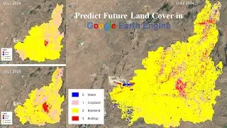
8. GEE 6: Landover classification Map
9. GEE 6: Exporting Raster and Vector Data
10. How to make a time-series chart for NDVI, NDWI, and other Indices?
11. Spectral indices and develop the skills for calculating any index (NDVI, NDWI, NDSI, MNDWI, MSAVI)
12. How to remove CLOUD Mask from satellite Images
13. Visualization (DEM) of Hill shade and Slope Map in GEE using NASA SRTM
14. GEE: How to make an NDVI chart over a period of time
15. Air Quality Monitoring: Nitrogen Dioxide (moll/m^2) density using GEE JavaScript API
16. Air Quality Monitoring: Sulphur Dioxide (moll/m^2) density using GEE JavaScript API
17. How to Download Air Quality parameters Time series data in CSV format using GEE
18. How to make Land Cover Classifications Charts in GEE | LULC Map Chart
19. Land Surface temperature in GEE || Observe temporal patterns in LST using a time series Chart in GEE
20. How to Calculate Average, Maximum & Minimum NDVI in GEE
21.GEE: How to ADD A LEGEND, Title in your Map
22. Calculating LULC Map Area in GEE
Online Training Benefits:
Course Certificate (After submitting all Assignments)
Materials (Slide, PDF)
Practice Code (All codes provide)
Recorded Class (All class recorded video provided)
Lifetime teaching support
Join Our Community:
Join the Telegram group: https://t.me/gisandremotesenginglearn...
#googleearthengine #remotesensing
Watch video Import Latitude & Longitude Coordinates to Google Earth Engine from CSV Excel file || Earth Engine online, duration hours minute second in high quality that is uploaded to the channel Study Hacks-Institute of GIS & Remote Sensing 10 January 2023. Share the link to the video on social media so that your subscribers and friends will also watch this video. This video clip has been viewed 4,847 times and liked it 52 visitors.