Microsoft and QGIS: a convenient way to get and use building contours
This video presents various ways to obtain the contours of buildings created by Microsoft based on the processing of satellite images in a neural network. Both paid and free ways of obtaining data, as well as the process of downloading and using them in QGIS, will be considered.
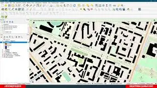
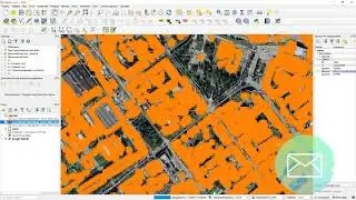
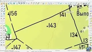
00:00 ► What building contours look like in QGIS and comparing them with OSM data.
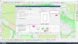
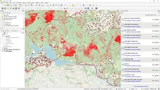
01:18 ► A paid method from NextGIS company within the borders of the subject of the Russian Federation.
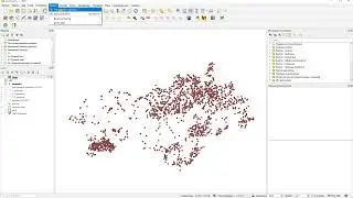
02:18 ► Free method based on links from GitHub.
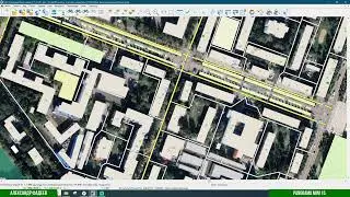
06:40 ► Facilitating the search and download to the relevant territory with a free option.
Watch video Microsoft and QGIS: a convenient way to get and use building contours online, duration hours minute second in high quality that is uploaded to the channel Александр Фадеев - Территория ГИС 11 November 2022. Share the link to the video on social media so that your subscribers and friends will also watch this video. This video clip has been viewed 1,355 times and liked it 50 visitors.


![-[ну точнее план б и в]](https://images.reviewsvideo.ru/videos/aHaoZxaL8pk)